Read the river before you launch


By Pamela Chergotis
MILFORD — The ice is out, the water is high, and the temptation to get into the water and shake off the winter of 2017-18 is growing by the day.
There are some fine resources online to help you plan your trip — or to decide whether a trip on any given day is wise. For example, the Upper Delaware, from Hancock to Milford, has some Class 2 rapids that will tip inexperienced boaters when the water is high. But during a hot, dry summer day, the river can be so low and slow, you'll end up dragging your boat, which isn't fun either.
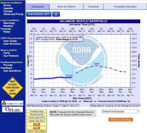
Take a lovely summery day like Saturday, for example. The water temperature rose to about 58 degrees, and the outdoor temps shot into the mid-70s. The water levels at the Barryville gauge were moderate, just under six feet, and way below the flood stage of 17 feet. All of that means it would have been safe for boaters to go out on the river on Saturday without a wetsuit, with rafting recommended for less experienced boaters. The water was moving at about 2 1/2 miles per hour, so a boater who put in at Ten Mile River would get to Lackawaxen, six miles away, in about 2 1/2 hours.
There is no one page offering all the information you need, so I have a folder with several bookmarked pages that I always consult before getting on the river. This is what you need to know:
The temperature of the water
The temperature of the air
Water levels (and danger levels) on the stretches where you plan to boat
Water speed on those stretches, to calculate the time from launch to destination.
Distance between boat launches, and whether they accommodate trailers or are for top carriers only.
Water temperature, water levelsSeveral sources provide this information:
The Upper Delaware River Hotline, at 845-252-7100, is a recorded message available 24 hours a day and updated daily during the boating season (it's not currently working, however). It provides the river height, air and water temperatures, boating conditions, and general river safety information. The Delaware Water Gap National Recreation Area page has some links to the U.S. Geological Service.
My go-to is the Advanced Hydrologic Prediction Service of the National Weather Service, at https://bit.ly/2qD9Gnn. It provides several days' worth of water levels — past, present, and future — along with more information than is strictly needed for a boat trip, like the highest crest ever recorded (35 feet, Montague, 1955) or flood damage costs since 1903. To get to other gauge locations on the river, navigate by clicking on the arrows, which appear midway down the page, tagged "Upstream Gauge" and "Downstream Gauge."
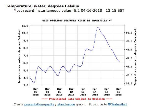
I also like the U.S. Geological Services Water Resources page, https://on.doi.gov/2J3bHRE, another information-rich site that can keep you occupied for hours, but which also quickly gives up the information you need: past and present (but not future) water levels for any range of dates you provide, plus water temperatures in both Celsius and Fahrenheit.
The Upper Delaware Scenic and Recreational River Area provides detailed information about each water level: you decide whether you are up to the challenge: https://bit.ly/1PITNp7.
For example, if you missed Saturday's good boating conditions and wanted to take a trip on Wednesday, just four days later, you'd find that the water levels were expected to reach nearly 8 feet at Barryville. Levels of 8 to 12 feet come with the warning: "These are very high water levels with very swift currents of 4 miles per hour and above. Increased hydraulics and undercurrents exist. Waves can be up to 8 feet. Floating debris, hazards and obstructions along the shoreline and in rapids are possible. Water temperatures decrease so wet or dry suits are recommended. Properly equipped rafts and/or enclosed boats are recommended. Highest skill level only!"
Okay, so maybe kayaking on a day like that is not such a good idea.
Air temperatureThis is easy: use your favorite weather report. I use the National Weather Service at weather.gov. Enter your zip code at the top left.
I've heard the rule of thumb is to wear special gear, like a wetsuit, when the temperature of the water and the temperature of the air, added together, equal less than 100 degrees. However, the National Park Service recommends staying off the river without a wetsuit whenever the water is below 50 degrees: https://bit.ly/1PITNp7.
Water speedThe Upper Delaware Scenic and Recreational Area lets you know how fast the river travels at each water level: https://bit.ly/1PITNp7. Wednesday's water levels will have you traveling at 4 miles per hour, while last Saturday's levels were only 2 1/2 miles per hour.
Distance between boat launchesThe Upper Delaware Scenic and Recreational Area's "Planning Your River Trip" page at https://bit.ly/2H77Bat offers a chart of distances between boat lauches from Hancock to Mongaup.
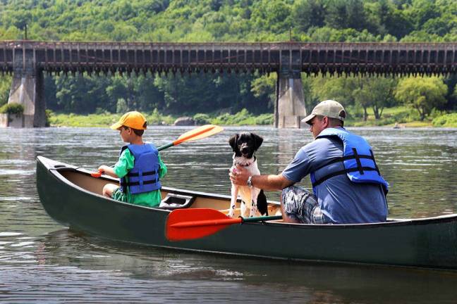
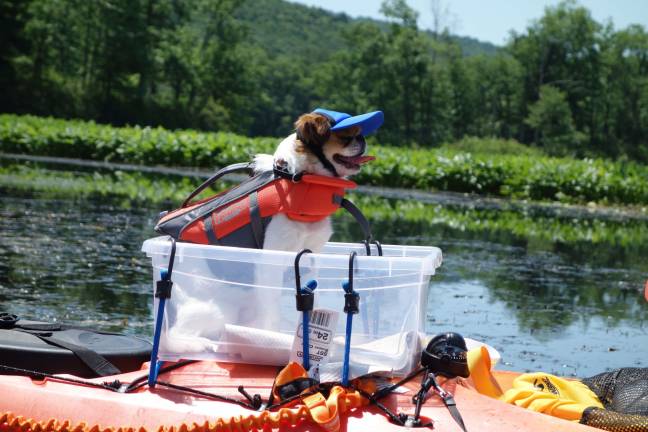
The page also includes a really helpful checklist of all the stuff you'll need for a safe and happy day on the river. It's worth mentioning, at every opportunity: never, ever get on the river without a Coast Guard-approved life jacket (dogs too!).
New Jersey offers a water trail guide with information about boat launch locations from Matamoras, Pa., to Trenton, N.J.: https://bit.ly/2IZY0Tq.
LiveriesDon't have a boat or the means to portage it? The Upper Delaware Scenic and Recreational River Area offers a list of liveries in the area that will supply everything you need for a day on the river, whether you'll be kayaking, canoeing, or rafting: https://bit.ly/2JT7NvI.
Did I mention to always wear your life jacket?
See you on the river!